
Showing posts with label off season travels. Show all posts
Showing posts with label off season travels. Show all posts
April 28, 2016
solo on the John Day River
I have a friend that's 70 years old. He's been a boater all his life and has untold experience, but has never done a solo trip. Recently he asked me; "what possessed you to go on the river for 9 days by yourself?"


January 17, 2016
Rum Therapy
Lisa and I seem to have been posted up on Jost Van Dyke for the past week. Rented a little 10'x10' plywood shack on the beach in White Bay. For 60/nt. the place comes with mosquitos, a festive blue and yellow paint job, the sound of the surf, and one kitty.
 |
| The view every night |
December 22, 2015
Winter Solstice at May Creek Cabin
Somehow we lucked out again! What better way to break up a drive from SLC to the Northwest than to hike into a backcountry cabin and spend the night.


January 17, 2015
Married in Mexico
Lisa and Mick
Jan 17th, 2015
Barcelo Maya Palace
Playa del Carmen, Mexico
Jan 17th, 2015
Barcelo Maya Palace
Playa del Carmen, Mexico

over 100 photos follow...
December 30, 2013
Winter Solstice in the Snowy Woods
A warm little cabin deep in the snowy woods on the winter solstice.... almost sounds too good to be true, but it certainly is, and here is the story.

February 4, 2013
On getting engaged
Here is a photo essay of the two and a half years leading up to Lisa and I getting engaged.
December 30, 2012
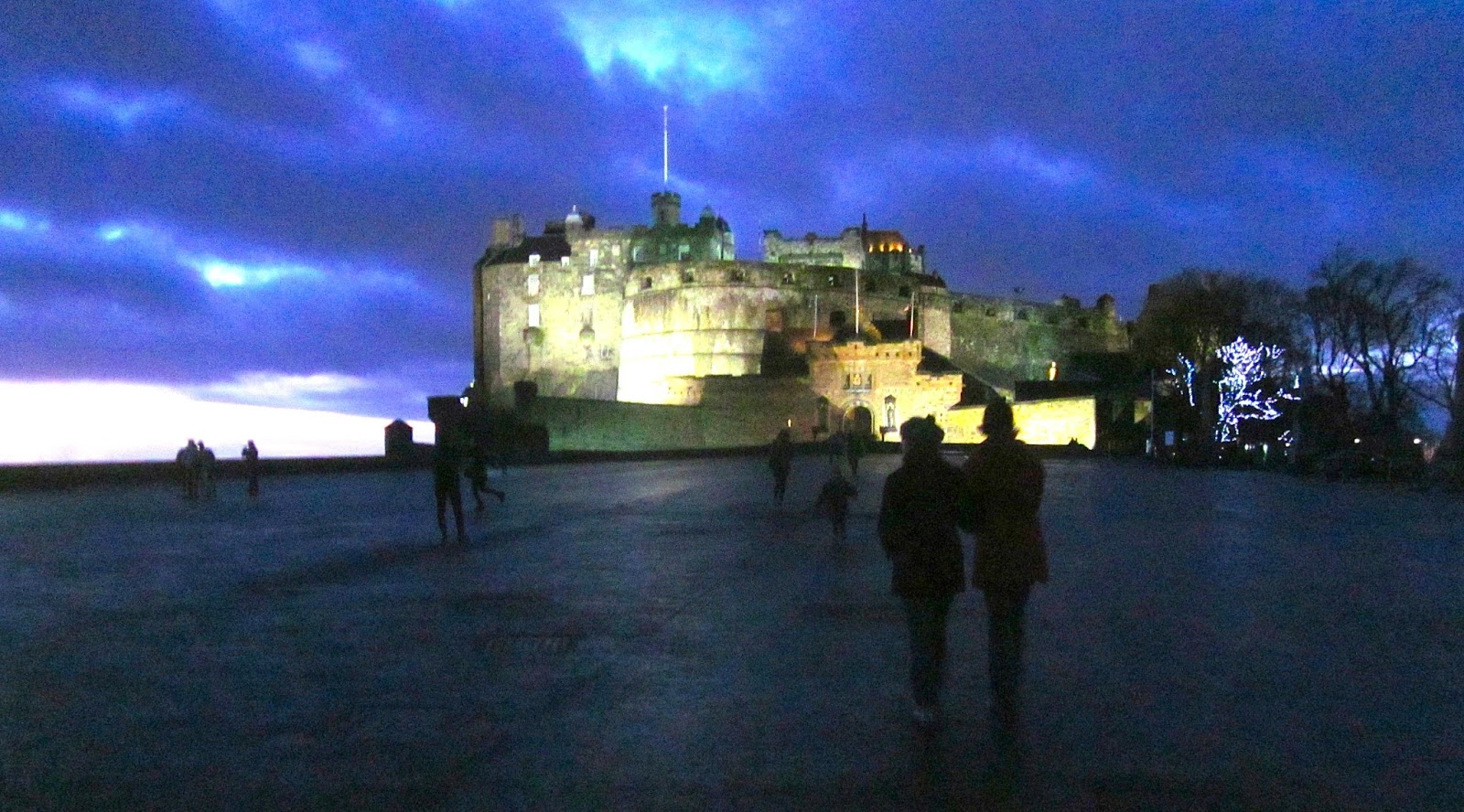
A Scottish Christmas
November 13, 2012
North Shore of Oahu

Lisa and I got an invite to a wedding in Hawaii. As if there couldn't be a better excuse to go to Hawaii........
March 1, 2012

November 29, 2011
A Grogg of the Ages
On Thanksgiving morning Mike and I wrestled an old cider press out into the driveway to dust it off. It's been a few years since the old beast saw the light of day.
February 20, 2011
Nicaragua to Panama


April 2, 2010
the big 4o in Alaska

Oh no, I'm gonna be forty, what do I do?
I wasn't really as hung up on it as it sounds, but that was the question that began rolling around my mind about a year ago.
November 5, 2009
Celebrating October; 23 days afloat
October is my favorite time to be out and about for a few reasons. The fall colors are unbelievable, and the harsh summer sun is tilted to the south so the shadows are long; the light soft, even at mid-day. The two combined; color and light, make for beauty beyond compare. I've got other reasons that I'll keep to myself for now.


March 20, 2009
West Desert - Newfoundland Mountains
Trevor and I left everyone else behind and headed for the Newfoundlands where we figured a couple days would do. We headed out that night to spend the spring solstice in the desert. Drove until 10pm or so and biviouaced on a knoll at the north boundary of the Air Force Range. Trips like this are why I need a set of offroad lights so I don't have to freak out quite so bad when the antelope jump out of nowhere. We woke on the first day of spring to a real nice day. Cooked eggs in the dutch oven on the stove top, and drank generous portions of coffee. Me trying to get a head start on a trip by leaving the night before just doesn't work out. By the time I drink coffee, cook breakfast, lounge around and get things packed up it's nearly noon, especially if it's cold in the morning. I guess it's not really a newsflash that winters are known for being cold in the morning. Truth be known, I like to sleep outside and wake up in a big open piece of desert, cold or not. Anyway we finally got loaded up and headed for the railroad causeway where we promptly got our doors blown off by a west bound Union Pacific freight train.


We decided to go to the west side of the Newfys first. The road almost immediately turns in to a track through the Greasewood brush where I wouldn't want to be when it's muddy. It'd be miles of terribly slow gumbo mud. We got down to Miners Basin and explored a couple of the trails going up into the foothills to abandon mine sites.

I liked the view to the west; across the Newfoundland Evaporation Basin towards Nevada and Pilot Peak.

Miners Basin Pass would be the ideal place to start a hike to Desert Peak, the highest in the Newfoundlands. We went back to the valley floor and continued south. After driving the road south for a while I noticed there were no other tracks. It'd been weeks since anyone passed this way which added to the already remote feeling. Coming across the signs of somebodys bad luck from days gone by also ominously reminds a backcountry traveler of the remote nature of the country through which they pass.

parking brake set...

we decided to take two vehicles...just incase

outta gas, somewhere on the west slope of the Newfoundland Mountains.

The end of the road. Air Force landia beyond the sign. BS! It's probably the real Area 51.


Sign says to call some number for passage. Actually Trevor is calling his brother to cuss him out. His Verizon really did work!

Old Dodge pickup tailgate the airforce didn't want anymore carefully placed in the desert.

We turned around and headed back north instead of going a couple hundred yards east and driving around the fence. I figure the govt. could make us go away and wouldn't want to press my luck. We found a spot on the north end of the range, with a view of the causeway in the valley below, to set up the springbar so we could get out of the wind storm that'd blown in during the day. The air was full of dust and we were glad to have the tent. Set up the table and chairs and stove inside and lounged with Miso soup.

It rained most of the night and cleared the air nicely. We wanted to go on south down the east side of the range but neither of us had the fuel capacity so we had to surrender to civilization and hydrocarbons. I need a jerry can! Too lazy to drive the few miles back around to the crossing so we just crossed! Until next time...


We decided to go to the west side of the Newfys first. The road almost immediately turns in to a track through the Greasewood brush where I wouldn't want to be when it's muddy. It'd be miles of terribly slow gumbo mud. We got down to Miners Basin and explored a couple of the trails going up into the foothills to abandon mine sites.

I liked the view to the west; across the Newfoundland Evaporation Basin towards Nevada and Pilot Peak.

Miners Basin Pass would be the ideal place to start a hike to Desert Peak, the highest in the Newfoundlands. We went back to the valley floor and continued south. After driving the road south for a while I noticed there were no other tracks. It'd been weeks since anyone passed this way which added to the already remote feeling. Coming across the signs of somebodys bad luck from days gone by also ominously reminds a backcountry traveler of the remote nature of the country through which they pass.

parking brake set...

we decided to take two vehicles...just incase

outta gas, somewhere on the west slope of the Newfoundland Mountains.

The end of the road. Air Force landia beyond the sign. BS! It's probably the real Area 51.


Sign says to call some number for passage. Actually Trevor is calling his brother to cuss him out. His Verizon really did work!

Old Dodge pickup tailgate the airforce didn't want anymore carefully placed in the desert.

We turned around and headed back north instead of going a couple hundred yards east and driving around the fence. I figure the govt. could make us go away and wouldn't want to press my luck. We found a spot on the north end of the range, with a view of the causeway in the valley below, to set up the springbar so we could get out of the wind storm that'd blown in during the day. The air was full of dust and we were glad to have the tent. Set up the table and chairs and stove inside and lounged with Miso soup.

It rained most of the night and cleared the air nicely. We wanted to go on south down the east side of the range but neither of us had the fuel capacity so we had to surrender to civilization and hydrocarbons. I need a jerry can! Too lazy to drive the few miles back around to the crossing so we just crossed! Until next time...

March 2, 2009
taking the long way to Death Valley
It was again time to scram on a road trip. On the multiple trips, my friends and I did to the West Desert this winter, we talked often of extending the trip to Death Valley because the gas prices were lower than they'd been in years, and the season was right.
January 1, 2009
West Desert - New Years Eve
Contemplating what to do for New Years Eve we headed for the West Desert. A loop trip that ended up being nearly 300 miles of dirt roads. The Pony Express trail around the south end of the Great Salt Lake, through Wendover, north along the Pilot Mtns. then east along the historic Transcontinental Railroad line, back to Ogden. I only got in a few pictures then realized that I didn't bring spare batteries. We camped out on the north end of the Fish Springs Mountains where there was plenty of ground with no snow cover. The views are what the West Desert is all about! The sunset and sunrise were no exceptions. What a way to ring in the new year.

Before heading out I checked on the weather (i.e. how much snow was on the ground) using the remote sensor stations that NOAA has scattered across the country. The accuracy of the remote sensors was spot on for the most part. Simpson Springs Pony Express Station.

Trevor heading out across the yawning expanse.


Before heading out I checked on the weather (i.e. how much snow was on the ground) using the remote sensor stations that NOAA has scattered across the country. The accuracy of the remote sensors was spot on for the most part. Simpson Springs Pony Express Station.

Trevor heading out across the yawning expanse.

December 18, 2008
The Yucatan - Cichen-Itza before the crowd
Anja and I took a trip down Yucatan way in December on my break between chemo rounds.


February 23, 2007
Grand Canyon
In the early spring of 2006 my friend Todd (pic'd below) came to Ogden for a couple days of backcountry skiing. He invited me to be part of a private group doing a 27 day river trip through the Grand Canyon the following Feb./Mar. I of course accepted without even thinking about it.


December 23, 2005
Baja California Sur
In Nov./Dec. Anja and I went to Baja Calif. Sur, traveling with backpacks. We traveled 16 days by bus, and hitchhiking, north to the Sierra de la San Fransisco to check out the 10,000 year old Cochimi rock art, a UNESCO world heritage site, simply referred to by the locals as La Cueva Pintada, (The Cave Painting). The rock art is geographically spread around a bit. The area we traveled to was in the bottom of a canyon called Canon San Pablo near the village of Santa Martha. Stone huts where the people live the way they must've lived 1000 years ago. Herding goats, making their own leather products like shoes and saddles for the few mules the village owns, goat milk, goat cheese, etc. The government authority, INAH (Instituto Nacional de Antropologia), strictly controls who enters the canyon. The pristine nature of the sites shows how effective the restriction is! You gotta hire an INAH approved guide to escort you the few days, down a single track, it takes to go there and back. We tried to stop at most of the towns along the 400 miles between Cabo and Sierra de San Fransisco mostly because it sucks to ride the bus for more than 3 or 4 hours at a time, and there's tons to see along the way.
Subscribe to:
Posts (Atom)