
This trip has been on my list of things to do for years.
I called the BLM in Baker, Oregon and ordered the permit info and river guide map in 2009 or so, then came really close to doing the trip in 2010, but the river became de-watered as it often does in mid summer. This year the stars finally aligned enough for a Grande Ronde float. To make it all the better I had Cody, my kid, and Erick, my brother along. This year we had about 4,000cfs registering on the USGS gauge at Troy. That was enough water so the trip was on, despite my ex almost calling the sheriff on me for kidnapping. We met in Lewiston at Wal-Mart so we could get groceries, and some other junk like bug spray. I did a quick repair to my 31 year old GMC, and we were off to drop Ericks truck at Heller Bar. The road and the rugged country from Asotin to Enterprise was a scenic wonder. We speculated how this road ever got here in the first place, and couldn't come up with a good answer so we just let the mystery be.

We made a stop in enterprise for a state required watercraft certification that says my boat is free of invasive species, such as quagga mussels. Such exotics have been devastating waters in the west for several years now and are getting worse. We got some dinner, and drove until well past dark to get to Minam State Park. When we woke in the morning it appeared that other people had the same idea that we did. It's always exciting to arrive somewhere new after dark and wake to the surprise in the morning. Although there were a few people it all worked out and no one was in each others way.


This float segment begins at Minam, Oregon with 9 miles of the Wallowa River, then joins the Grande Ronde. The upper river from Minam to Troy is the more popular segment to float. It's steep walled, forested, and terribly rugged. A large segment of the Grande Ronde is federally designated Wild & Scenic. The camp sites on this segment are open, forested, flat, and some of the most beautiful I've ever seen. It's certainly understandable why this is a popular segment.
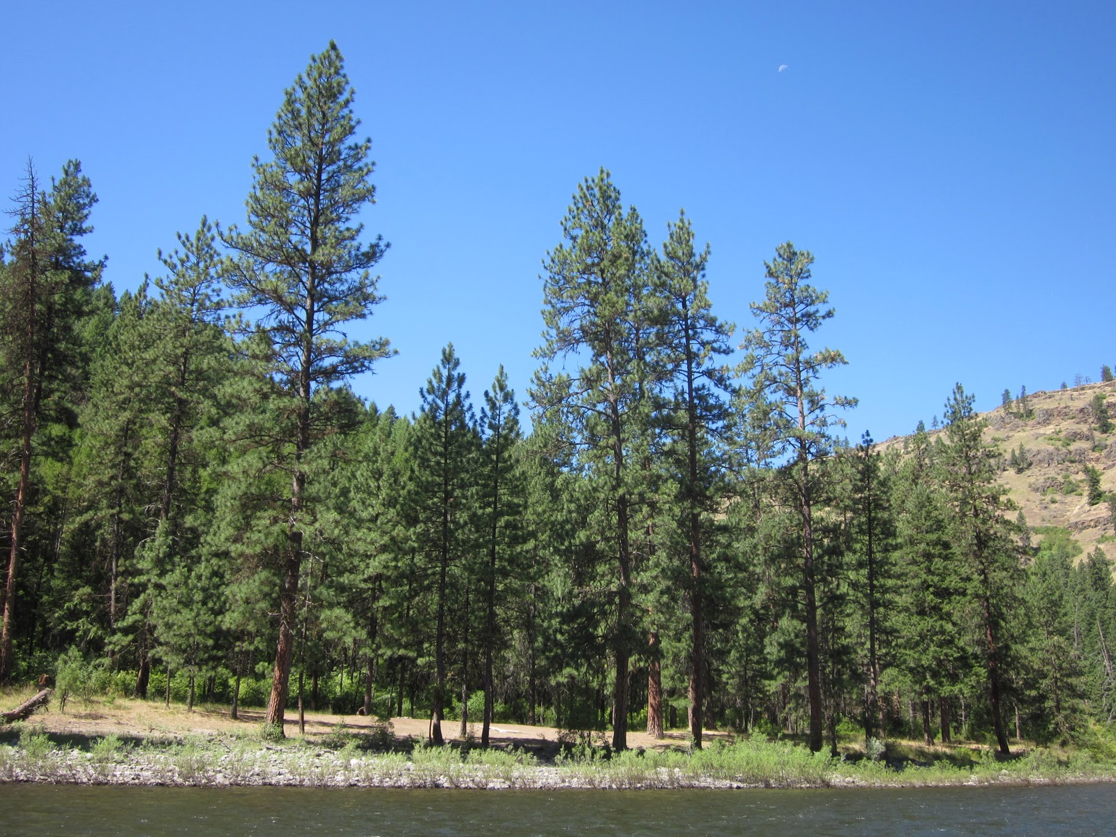


The rapids on the upper river were not too difficult, but it was a fun current that was fast, constant boat handling being necessary. My boat is more designed for the high volume rivers of the southwest, but it was still pretty easy to navigate the channel without hitting rocks.
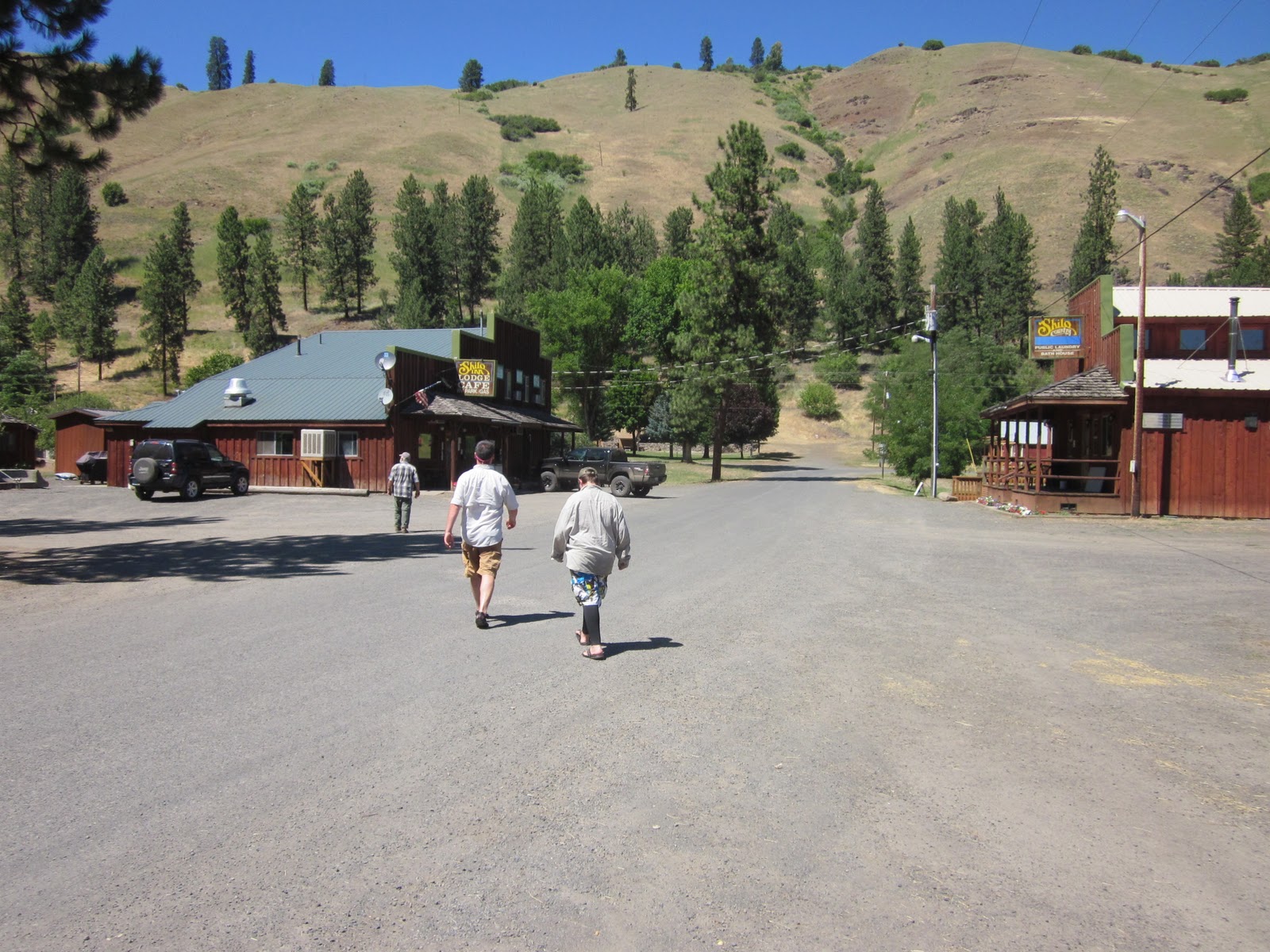
We rowed into Troy, Oregon on the third day and tied up in the water running out of the Wenaha River. It was a neat little town accessed by dirt road. I was surprised to see that main street sported a Shilo Inn. The sign was even in the same font as the big fancy Shilos throughout the Northwest. We thought someone was joking, but sure enough, it's owned by the same owner. We got our ice, skipped the burger and beer, and went back to the boat for lunch, and to watch some folks from the Tri-cities jump off the bridge.


The Lower river was characterized by still beautiful camp sites, but not as numerous. The river was wider below Troy, making navigating the shallows an extra challenge.


We tied up the raft under the Hwy 129 bridge at Boggans Oasis. We sat in the shade, ate some lunch, and walked up to the cafe to re-supply our drinking water. I found out later that this bridge is on the Nat'l Register of Historic Places.


The next day would come the long anticipated Narrows Rapid. The night before the Narrows, our last night on the river, we had a bit of a problem finding a campsite. After several unsuccessful landings and scouts we just rat-holed into a cobble beach. It looked a little like a long shot when we first checked it out, but it was late, and we were tired, so one way or the other, this was home for the night. These kind of camps always end up being kind of an interesting novelty. It takes a bit of creativity and resourcefulness to settle into such a place so when you done it produces a bit of satisfaction.


The water looked really low when we got to the scout for The Narrows. The rattlesnake on the scout trail was way more of a hazard than the rapid was. I said the hell with scouting it and walked back to the boat. That snake was as big around as a beer can and who knows how long it was, but it was big enough. It was a pretty straight forward entry, and very interesting geologically.


After running The Narrows we had only about 4 miles to go before the take-out at Heller Bar. We quietly floated the last few miles in the soft light of morning.

The river guide map that i mentioned at the beginning of this write up was put together by BLM and I think they did a pretty good job of it. All the map pages are titled with letters (eg. Map A, map B, etc) After a couple days afloat Cody and Erick and I started goofing around and naming all the map pages. So the index below is how we chose to name our map pages with an accompanying short story of how the respective names came to be.
Map A: Aquatic permit in Enterprise
Map B: Bear Canyon 3 times? (because there are 3 bear canyons entering the Grande Ronde on the trip)
Map C: Cody
Map D: Drove for 2 days to get to the river
Map E: Erick
Map F: Filth
Map G:
Map H: Home on night one (1st night camp on this map page)
Map I: Idiots and their McMansions (because of the McMansion perched on the hill above the river)
Map J: Jeep trail of death (ridiculously steep jeep trail coming down to the river)
Map K: Krussow (3 of us)
Map L: Luigi (named after the plates Cody and I picked up at the thrift store in Lewiston since we forgot to bring plates. They had a picture on the surface of a chubby Italian guy flipping burgers so we named him, and the plates Luigi.)
Map M: Mick
Map N: No fish sauce (we forgot the fish sauce for the red curry recipe)
Map O: Only one named Island
Map P: Plenty O' Planted Pines (lots of pine trees planted recently in and around campsites)
Map Q:
Map R: Riley cookies (Erick brought a bunch of cookies from Hood River that Riley (my niece) made for our trip)
Map S: Shoulda brought fishin' poles (lots of fish all over in the river, they would've made good dinner)
Map T: Trolley wire rope swing (somebody set up a rope swing not from a tree, but from an abandoned cable across the river)
Map U:
Map V: Vineyard mansion (huge vineyard ranch)
Map W:
Map W was the last map page of the river guide.
No comments:
Post a Comment